CHRISTOPHER ANDREWS ARCHITECT & TOWN PLANNER
|
|
|
PART III: THE REGULATING PLAN
|
|
|
|
|
a
Preliminary layout of streets, blocks
and public spaces |
|
|
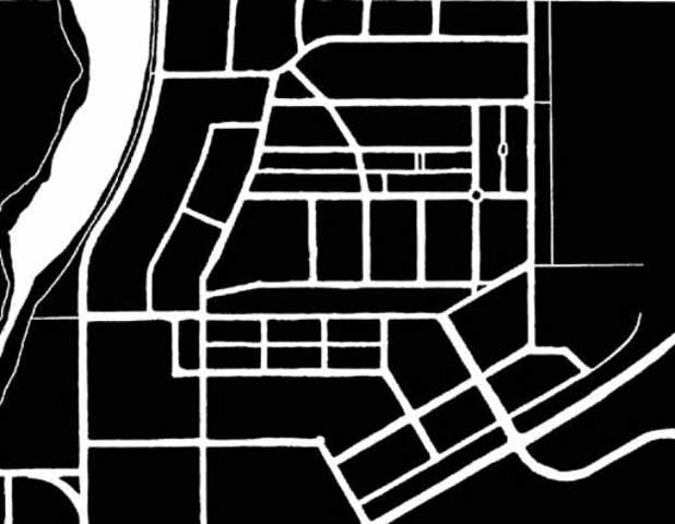
The
initial vision for the Channahon Village Center proposes a process of
incremental and piecemeal growth. This
growth happens within the framework of a schematic layout for the infrastructure
of streets, blocks and public spaces. This layout could be implemented either as a regulating plan
which would be pre-approved by the stakeholders or as a model plan which would
set parameters for the prototypical relationships of the streets, blocks and
public open spaces, to be further refined incrementally over time, according to
this model. The
preliminary layout that follows was meant to be viewed as a simulation.
It was developed on a large scale pencil drawing, which allowed for
multiple revisions. This drawing
included the layout of individual lots and buildings.
This finer grain investigation informed the genesis of this process and
often required that the larger scale steps be amended to reflect decisions and
discoveries made at the smaller scales. The
actual process of implementing such a plan should reflect a similar
understanding.
|
|
|
|
|
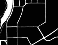
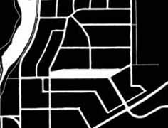
| The Existing Site Conditions |
Step One: Site Access and Through Roads |
|
|
In this first step, the major points of entry to the site are connected so as to provide a balanced level of access through and within the site. The three major boundary geometries of the site: the highway, the I & M Canal, and the cardinal point orientation of the range and township land division determine the geometry of these connections.
|
|
|
|
|
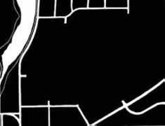
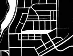
Step
two: The Village Green connects |
Step three: Secondary Roads connect
the through roads |
|
|
A system of secondary roads
form the major vehicle and pedestrian circulation within the site.
They connect the through roads and the Village Green.
They respond to and reinforce the major boundary geometries.
|
|
|
|
|
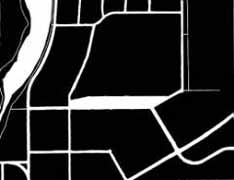
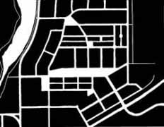
Step Four: The network of local
access streets and alleys |
Step five: neighborhood scale public
open spaces |
|
The larger scale blocks
defined by the major through roads and secondary access roads are further
divided by a network of local access streets and alleys.
|
At the neighborhood scale
more intimate public open spaces, small plazas, parks and playgrounds are
provided.
|
|
FORWARD TO CHANNAHON PART IV: INCREMENTAL DEVELOPMENT
|
BACK TO CHANNAHON PART II: SUSTAINABLE STREETS
|
|
BACK TO TOWN PLANNING PROJECTS
|
|
|
|
|||||